Category:Damrak, Amsterdam
Jump to navigation
Jump to search
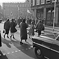
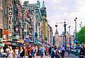
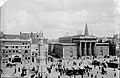
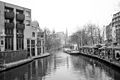
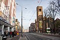
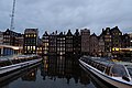
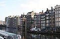
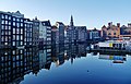
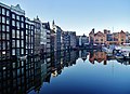
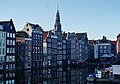
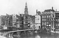
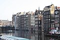
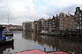
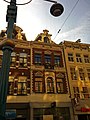
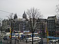
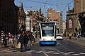
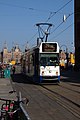
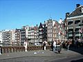
English: The Damrak is a partially filled in canal at the centre of Amsterdam, between Amsterdam Centraal railway station and Dam Square, running north-south. It is the main street where people arriving at the station enter the centre of Amsterdam. Also it is one of the two GVB tram routes from the station into the centre, with lines 4, 9, 16, 24, and 25 running down it. It is also on the route of the North/South Line (Amsterdam metro line) being constructed between the existing metro station at Centraal Station and the new Rokin station.
Nederlands: Het Damrak in Amsterdam is een straat en een water tussen de Dam en het Centraal Station.
street in Amsterdam, Netherlands  | |||||
| Upload media | |||||
| Instance of | |||||
|---|---|---|---|---|---|
| Location | Amsterdam-Centrum, Amsterdam, North Holland, Netherlands | ||||
| Street address |
| ||||
| Connects with | |||||
 | |||||
Subcategories
This category has the following 28 subcategories, out of 28 total.
A
- Accijnshuis (Amsterdam) (9 F)
B
- De Bisschop (before 1899) (26 F)
C
- Cineac (Amsterdam) (10 F)
D
- Damrak (kraakpand) (4 F)
- Damrak 21-22, Amsterdam (8 F)
- Damrak 25, Amsterdam (11 F)
- Damrak 44, Amsterdam (1 F)
- Damrak 60, Amsterdam (6 F)
- Damrak 63-64, Amsterdam (2 F)
- Damrak 70-79, Amsterdam (6 F)
- Damrak 88, Amsterdam (3 F)
- Damrak 89, Amsterdam (1 F)
- Damrak 95-96, Amsterdam (12 F)
- Damrak 98, Amsterdam (22 F)
- De Utrecht (Amsterdam) (47 F)
H
K
- Korenbeurs, Amsterdam (52 F)
L
O
P
- Pand van De Algemeene (empty)
V
Media in category "Damrak, Amsterdam"
The following 200 files are in this category, out of 889 total.
(previous page) (next page)-
 "The Grasshopper" am Damrak in Amsterdam.jpg 3,333 × 4,000; 8.31 MB
-

-
 02-06-1947 01049 Kiosk (4176882783).jpg 747 × 1,000; 145 KB
-
 03-14-1949 05864 Werkzaamheden aan de tramrails (5023986500).jpg 760 × 1,024; 180 KB
-
 03-18-1949 05867 Modeshow Cervan (5838882256).jpg 912 × 1,200; 215 KB
-
 05-04-1950 07496 Dodenherdenking (34313524681).jpg 2,081 × 2,673; 395 KB
-
 07-15-1947 02163 In rij voor rondvaart (11465364825).jpg 1,600 × 1,195; 375 KB
-
 08-31-1948 05255 Troonswisseling (5521976549).jpg 1,654 × 1,649; 339 KB
-
 09-00-1948 05263 Holland-Amerika Lijn (16033008151).jpg 1,600 × 1,203; 210 KB
-
 09-18-1951 09859B Kettingbotsing Damrak (5377295537).jpg 2,048 × 1,661; 585 KB
-

-
 1 mei grote drukte van toeristen in Amsterdam bij rondvaarthaven, Bestanddeelnr 916-3787.jpg 2,635 × 2,644; 1.44 MB
-
 1 mei grote drukte van toeristen in Amsterdam bij rondvaarthaven, Bestanddeelnr 916-3788.jpg 2,635 × 2,636; 1.24 MB
-
 1 mei grote drukte van toeristen in Amsterdam, Bestanddeelnr 916-3783.jpg 2,599 × 2,636; 1.26 MB
-
 11-22-1958 15550 Intocht Sint (2828002430).jpg 1,169 × 1,155; 186 KB
-
-

-
 1979 Netherlands Amsterdam Holiday 51.jpg 732 × 495; 184 KB
-
 1994-07-14 Amsterdam - (13).jpg 1,920 × 1,279; 357 KB
-
 2004 Damrak, Amsterdam 01.jpg 2,220 × 1,509; 2.98 MB
-
 2004 Damrak, Amsterdam 02.jpg 1,965 × 1,499; 2.26 MB
-
 2004 Damrak, Amsterdam 03.jpg 2,213 × 1,493; 2.71 MB
-
 2011-05-12 Oostbuis.jpg 3,888 × 2,592; 4.33 MB
-
 2011-05-12 Startschacht Damrak.jpg 4,000 × 3,000; 2.53 MB
-
 2020 Justus van Mauriktegel.jpg 5,312 × 2,988; 6.76 MB
-
 20220525.Amstedam.-025.jpg 8,000 × 6,000; 12.44 MB
-
 20220525.Amstedam.-027.jpg 8,757 × 6,567; 7.49 MB
-
 36 - Amsterdam - 20526088 - RCE.jpg 1,200 × 900; 154 KB
-
 A T Rooswinkel, Afb 010005000229.jpg 2,028 × 1,320; 452 KB
-
 A T Rooswinkel, Afb 010005000250.jpg 2,040 × 1,320; 424 KB
-
 A T Rooswinkel, Afb 010005000256.jpg 2,016 × 1,344; 448 KB
-
 A T Rooswinkel, Afb 010005001389.jpg 2,040 × 1,338; 468 KB
-
 A T Rooswinkel, Afb 010005001395.jpg 2,046 × 1,338; 457 KB
-
 A T Rooswinkel, Afb 010005001396.jpg 2,052 × 1,338; 423 KB
-
 A T Rooswinkel, Afb 010094000741.jpg 1,878 × 1,269; 423 KB
-
 A T Rooswinkel, Afb 010094000750.jpg 1,872 × 1,281; 439 KB
-
 A T Rooswinkel, Afb ANWN00294000001.jpg 1,995 × 1,309; 276 KB
-
 A T Rooswinkel, Afb B00000031223.jpg 6,070 × 3,967; 3.71 MB
-
 A T Rooswinkel, Afb B00000031226.jpg 6,858 × 5,004; 3.15 MB
-
-
 Aalsmeer Bloemencorso, Amsterdam, Bestanddeelnr 924-9018.jpg 3,696 × 2,459; 1.84 MB
-
 Aalsmeer Bloemencorso, Amsterdam, Bestanddeelnr 924-9019.jpg 3,696 × 2,459; 1.95 MB
-
 Aalsmeer Bloemencorso, Amsterdam, overzicht Dam negagiefstrook, Bestanddeelnr 924-9013.jpg 3,696 × 2,459; 1.68 MB
-
 Aalsmeer Bloemencorso, Amsterdam, overzicht Dam, Bestanddeelnr 924-9014.jpg 2,459 × 3,696; 1.61 MB
-
 Aankomst Prins Carnaval en Zotten van Suikertent, Bestanddeelnr 905-0830.jpg 3,375 × 2,859; 2.06 MB
-
 Achtergevels aan water en schip - Amsterdam - 20329159 - RCE.jpg 1,200 × 794; 168 KB
-
 Achterkant Warmoesstraat (vom Damrak aus gesehen) - panoramio.jpg 3,353 × 2,084; 741 KB
-
 Adidas Bike - panoramio.jpg 2,048 × 1,536; 1.76 MB
-
 Afgebroken huizen - Amsterdam - 20411367 - RCE.jpg 899 × 1,200; 129 KB
-
 Afgebroken huizen - Amsterdam - 20411368 - RCE.jpg 871 × 1,200; 122 KB
-
 After Queensday (4511180965).jpg 1,200 × 800; 342 KB
-

-
-
-
 Albert Greiner Afb OSIM00001003301.jpg 1,834 × 1,256; 265 KB
-
 Albert Greiner Afb OSIM00001005357.jpg 1,999 × 2,568; 726 KB
-
 Albert Greiner Afb OSIM00001005908.jpg 3,265 × 2,097; 432 KB
-
 AMS central station 7.jpg 2,048 × 1,536; 2.49 MB
-
 Amstel am Damm (6).JPG 424 × 640; 246 KB
-
 Amsterdam (14402035663).jpg 2,571 × 997; 538 KB
-
 Amsterdam (15870925548).jpg 4,272 × 2,848; 7.6 MB
-
 Amsterdam (15870947508).jpg 2,848 × 4,272; 11.63 MB
-
 Amsterdam (15873186957).jpg 4,272 × 2,848; 8.95 MB
-
 Amsterdam (15873526267).jpg 4,272 × 2,848; 6.92 MB
-
 Amsterdam (16032561336).jpg 2,848 × 4,272; 7.54 MB
-
 Amsterdam (16032990976).jpg 4,272 × 2,848; 7.02 MB
-
 Amsterdam (16033061376).jpg 4,272 × 2,848; 10.02 MB
-
 Amsterdam (16056406711).jpg 2,848 × 4,272; 10.34 MB
-
 Amsterdam (16056537221).jpg 4,272 × 2,848; 7.77 MB
-
 Amsterdam (16056586531).jpg 2,848 × 4,272; 5.33 MB
-
 Amsterdam (16056702711).jpg 4,272 × 2,848; 10.67 MB
-
 Amsterdam (16057765842).jpg 4,272 × 2,848; 8.88 MB
-
 Amsterdam (16058064412).jpg 4,272 × 2,848; 8.52 MB
-
 Amsterdam (16058335815).jpg 2,848 × 4,272; 7.72 MB
-
 Amsterdam (16058484435).jpg 4,272 × 2,848; 9.62 MB
-
 Amsterdam (164629649).jpeg 1,311 × 2,048; 479 KB
-
 Amsterdam (27838995117).jpg 3,180 × 4,770; 8.8 MB
-
 Amsterdam (4095362704).jpg 2,640 × 1,760; 3.89 MB
-
 Amsterdam (4095363814).jpg 2,599 × 1,732; 3.98 MB
-
 Amsterdam (42658646482).jpg 4,868 × 3,245; 6.7 MB
-
 Amsterdam (5716397597).jpg 3,840 × 2,391; 4.25 MB
-
 Amsterdam (8807344309).jpg 3,872 × 2,592; 9.46 MB
-
 Amsterdam - 2013 - panoramio (5).jpg 4,608 × 3,072; 5.98 MB
-
 Amsterdam - 2013 - panoramio (6).jpg 4,608 × 3,072; 6.44 MB
-
 Amsterdam - Dam Square - View on Damrak, Beurs van Berlage & Bijenkorf.jpg 4,006 × 2,652; 5.38 MB
-
 Amsterdam - Damrak (6060472122).jpg 2,136 × 1,430; 1.22 MB
-
 Amsterdam - Damrak - View ENE on 'Beurs van Berlage' 1898-1903 by Hendrik Petrus Berlage.jpg 6,048 × 4,032; 18.28 MB
-
 Amsterdam - Damrak - View South.jpg 3,024 × 2,016; 5.46 MB
-
 Amsterdam - Damrak - View SSE on Beursplein.jpg 6,048 × 4,032; 21.82 MB
-
 Amsterdam - Damrak - View SW.jpg 2,016 × 3,024; 4.31 MB
-
 Amsterdam - Damrak v3.jpg 4,032 × 3,024; 3.42 MB
-
 Amsterdam - Objecten met verlichting.jpg 4,032 × 3,024; 2.83 MB
-
 Amsterdam - Oudebrugsteeg - Damrak - View North - Art Nouveau architecture.jpg 5,842 × 3,894; 14.19 MB
-
 Amsterdam - panoramio (132).jpg 3,456 × 2,304; 4.3 MB
-
 Amsterdam - panoramio (140).jpg 1,024 × 1,536; 438 KB
-
 Amsterdam - panoramio (141).jpg 1,920 × 1,280; 741 KB
-
 Amsterdam - panoramio (260).jpg 2,816 × 2,112; 3.22 MB
-
 Amsterdam - panoramio (5).jpg 2,976 × 3,968; 1.97 MB
-
 Amsterdam - panoramio - Maksym Kozlenko.jpg 1,800 × 1,350; 602 KB
-

-
 Amsterdam - Prins Hendrikkade - Nieuwebrugsteeg - View SW along Damrak.jpg 5,946 × 3,964; 16.62 MB
-
 Amsterdam 05 2013 - panoramio (4).jpg 2,592 × 3,888; 5.68 MB
-
 Amsterdam 05 2013 - panoramio (5).jpg 3,888 × 2,592; 6.2 MB
-
 Amsterdam 11.04.2012 - panoramio (10).jpg 2,592 × 1,944; 2.99 MB
-
 Amsterdam 11.04.2012 - panoramio (2).jpg 2,592 × 1,944; 2.88 MB
-
 Amsterdam 11.04.2012 - panoramio (5).jpg 2,592 × 1,944; 2.91 MB
-
 Amsterdam 11.04.2012 - panoramio (51).jpg 1,944 × 2,592; 1.92 MB
-
 Amsterdam 11.04.2012 - panoramio (7).jpg 2,592 × 1,944; 2.96 MB
-
 Amsterdam 1912 Damrak.jpg 1,624 × 1,046; 551 KB
-
 Amsterdam 1978 Street Scene.jpg 1,798 × 1,178; 182 KB
-
 Amsterdam am Hauptbahnhof stitched 1.jpg 7,262 × 2,612; 2.94 MB
-
 Amsterdam am Hauptbahnhof stitched 2.jpg 6,273 × 4,134; 3.18 MB
-
 Amsterdam bike taxi.jpg 3,264 × 2,448; 3.59 MB
-
 Amsterdam Canals (Ank Kumar) 10.jpg 6,000 × 4,000; 5.39 MB
-
Amsterdam casino - SoundCloud - Dirk-Jan Hanegraaff.ogg 2 min 4 s; 7.32 MB
-
 Amsterdam Centraal - panoramio (10).jpg 4,839 × 3,200; 5.49 MB
-
 Amsterdam Centraal Station 1977 by-dpc.jpg 1,194 × 806; 234 KB
-
 Amsterdam Damrak 001.JPG 3,390 × 1,801; 1.84 MB
-
 Amsterdam Damrak 1.jpg 4,564 × 2,940; 4.32 MB
-
 Amsterdam Damrak 2.jpg 4,530 × 3,288; 4.51 MB
-
 Amsterdam Damrak 3.jpg 4,586 × 3,211; 4.75 MB
-
 Amsterdam Damrak 4.jpg 4,579 × 3,265; 4.83 MB
-
 Amsterdam Damrak 5.jpg 4,574 × 3,293; 4.47 MB
-
 Amsterdam Damrak 6.jpg 4,592 × 3,193; 4.84 MB
-
 Amsterdam Damrak 7.jpg 2,929 × 4,348; 3.24 MB
-
 Amsterdam Damrak 8.jpg 4,393 × 2,749; 4.29 MB
-
 Amsterdam Damrak 9.jpg 4,559 × 3,307; 5.82 MB
-
 Amsterdam Damrak met Nieuwe Brug.jpg 3,431 × 2,259; 872 KB
-
 Amsterdam Damrak met Oudebrug 01.jpg 1,831 × 1,110; 262 KB
-
 Amsterdam Damrak met Papenbrug 01.jpg 740 × 480; 60 KB
-
 Amsterdam Damrak met zicht vanaf bijenkorf tot het beursgebouw (4094230424).jpg 2,640 × 1,760; 3.79 MB
-
 Amsterdam Damrak tram 822 naar Centraal Station (37145364323).jpg 4,790 × 2,692; 5.57 MB
-
 Amsterdam Damrak v1.jpg 4,032 × 3,024; 3.71 MB
-
 Amsterdam Damrak, Bestanddeelnr 254-9358.jpg 2,551 × 2,561; 914 KB
-
 Amsterdam damrak.JPG 2,276 × 1,928; 1.05 MB
-
 Amsterdam Damrak.JPG 3,648 × 2,736; 2.82 MB
-
 Amsterdam Evening (52142665159).jpg 4,725 × 2,658; 11.84 MB
-
 Amsterdam Experience souvenir shop (26251629676).jpg 5,184 × 3,456; 7.07 MB
-
 Amsterdam GVB 2094 (Dirk reclame) Damrak (28715757904).jpg 5,709 × 3,306; 8.57 MB
-
 Amsterdam GVB Combino 2098 (buurtentram) Damrak (29288886201).jpg 5,939 × 3,940; 10.65 MB
-
 Amsterdam living - panoramio.jpg 1,600 × 1,146; 329 KB
-
 Amsterdam Tram 795.jpg 2,592 × 1,728; 3.16 MB
-
 Amsterdam Zentrum 20091106 002.JPG 4,272 × 2,848; 4.7 MB
-
 Amsterdam Zentrum 20091106 005.JPG 4,272 × 2,848; 4.23 MB
-
 Amsterdam Zentrum 20091106 006.JPG 4,272 × 2,848; 4.41 MB
-
 Amsterdam Zentrum 20091106 008.JPG 4,272 × 2,848; 4.07 MB
-
 Amsterdam Zentrum 20091106 009.JPG 4,272 × 2,848; 4.48 MB
-
 Amsterdam Zentrum 20091106 010.JPG 4,272 × 2,848; 4.1 MB
-
 Amsterdam Zentrum 20091106 011.JPG 2,848 × 4,272; 3.6 MB
-
 Amsterdam Zentrum 20091106 012.JPG 2,848 × 4,272; 3.36 MB
-
 Amsterdam Zentrum 20091106 013.JPG 2,848 × 4,272; 3.46 MB
-
 Amsterdam Zentrum 20091106 014.JPG 2,848 × 4,272; 3.35 MB
-
 Amsterdam Zentrum 20091106 021.JPG 4,272 × 2,848; 4.26 MB
-
 Amsterdam Zentrum 20091106 024.JPG 4,272 × 2,848; 4.55 MB
-
 Amsterdam(j2r1) (16058644922).jpg 4,272 × 2,848; 9.89 MB
-
 Amsterdam(otzw) (15873841017).jpg 2,848 × 4,272; 14.6 MB
-
 Amsterdam(v4uo) (16057630151).jpg 4,272 × 2,848; 7.93 MB
-
 Amsterdam, 03.01.11-03.JPG 2,592 × 3,872; 4.1 MB
-
 Amsterdam, 03.01.11-04.JPG 3,872 × 2,592; 3.95 MB
-
 Amsterdam, 03.01.11-05.JPG 3,872 × 2,592; 3.78 MB
-
 Amsterdam, 03.01.11-06.JPG 3,872 × 2,592; 3.84 MB
-
 Amsterdam, 03.01.11-07.JPG 3,872 × 2,592; 4.02 MB
-
 Amsterdam, 03.01.11-08.JPG 3,872 × 2,592; 3.9 MB
-
 Amsterdam, 03.01.11-26.JPG 3,872 × 2,592; 3.69 MB
-
 Amsterdam, 03.01.11-27.JPG 3,872 × 2,592; 4 MB
-
 Amsterdam, 03.01.11-28.JPG 3,872 × 2,592; 3.88 MB
-
 Amsterdam, 03.01.11-29.JPG 3,872 × 2,592; 4.16 MB
-
 Amsterdam, 03.01.11-30.JPG 3,872 × 2,592; 3.42 MB
-
 Amsterdam, 03.01.11-31.JPG 3,872 × 2,592; 3.13 MB
-
 Amsterdam, 03.01.11-32.JPG 3,872 × 2,592; 3.43 MB
-
 Amsterdam, 03.01.11-33.JPG 3,872 × 2,592; 3.38 MB
-
 Amsterdam, 2000 (50269628433).jpg 2,426 × 1,378; 802 KB
-
 Amsterdam, cesta k nádraží.jpg 4,770 × 3,178; 3.31 MB
-
 Amsterdam, Damrak 19.JPG 2,592 × 3,888; 3.04 MB
-
 Amsterdam, damrak.jpg 3,612 × 2,881; 1.15 MB
-

-
 Amsterdam, Holanda - panoramio (12).jpg 4,288 × 3,216; 3.13 MB
-
 Amsterdam, Holanda - panoramio (2).jpg 4,288 × 3,216; 2.65 MB
-
 Amsterdam, Holanda - panoramio (32).jpg 3,456 × 5,184; 3.1 MB
-
 Amsterdam, Holanda - panoramio (4).jpg 4,288 × 3,216; 2.99 MB
-
 Amsterdam, Holanda - panoramio (9).jpg 4,288 × 3,216; 2.88 MB
-
 Amsterdam, June 2009 (4153852322).jpg 770 × 1,024; 476 KB
-
 Amsterdam, junho de 2011 - panoramio (11).jpg 635 × 850; 438 KB
-
 Amsterdam, Netherlands (Unsplash 2Hs8zbwOLDA).jpg 5,184 × 3,456; 15.52 MB
-
 Amsterdam, Netherlands - panoramio (2).jpg 3,072 × 2,304; 1.11 MB
-
 Amsterdam, Netherlands - panoramio (28).jpg 3,000 × 4,000; 3.78 MB
-
 Amsterdam, Netherlands - panoramio (4).jpg 3,072 × 2,304; 1.01 MB
-
 Amsterdam, Netherlands - panoramio (5).jpg 3,072 × 2,304; 1.2 MB
-
 Amsterdam, přjíždějící tramvaj III.jpg 4,770 × 3,178; 2.59 MB
-
 Amsterdam, The Netherlands (Damrak) - panoramio.jpg 2,400 × 1,800; 655 KB
-
 Amsterdam, tramvaj u nádraží.jpg 3,178 × 4,770; 2.42 MB
-
 Amsterdam, tramvajová rekonstrukce.jpg 3,178 × 4,770; 2.33 MB
-

-
 AmsterdamCentrum.JPG 640 × 480; 173 KB
-
 Amsterdamer Tram.JPG 2,304 × 3,072; 1.67 MB
-
 Amsterdams eerste stadsarcheoloog Jan Baart (l) in de bouwput, Bestanddeelnr 925-6883.jpg 3,671 × 2,441; 1.74 MB
-
 Amsterdams eerste stadsarcheoloog Jan Baart (l) in de bouwput, Bestanddeelnr 925-6884.jpg 2,441 × 3,671; 1.95 MB
-

-

-


.jpg)
.jpg)
.jpg)
.jpg)
.jpg)
.jpg)
.jpg)
.jpg)


.jpg)


.jpg)


_-_panoramio.jpg)


.jpg)


.JPG)
.jpg)
.jpg)
.jpg)
.jpg)
.jpg)
.jpg)
.jpg)
.jpg)
.jpg)
.jpg)
.jpg)
.jpg)
.jpg)
.jpg)
.jpg)
.jpeg)
.jpg)
.jpg)
.jpg)
.jpg)
.jpg)
.jpg)
.jpg)
.jpg)

.jpg)


.jpg)
.jpg)
.jpg)
.jpg)
.jpg)


.jpg)
.jpg)
.jpg)
.jpg)
.jpg)
.jpg)
.jpg)


_10.jpg)
.jpg)


.jpg)
.jpg)


.jpg)
.jpg)
_Damrak_(28715757904).jpg)
_Damrak_(29288886201).jpg)


_(16058644922).jpg)
_(15873841017).jpg)
_(16057630151).jpg)


.jpg)


.jpg)
.jpg)
.jpg)
.jpg)
.jpg)
.jpg)
.jpg)
.jpg)
.jpg)
.jpg)
.jpg)
.jpg)

_-_panoramio.jpg)


_in_de_bouwput,_Bestanddeelnr_925-6883.jpg)
_in_de_bouwput,_Bestanddeelnr_925-6884.jpg)


,_RP-F-00-944-3.jpg)
.jpg)